Geolocate

El Porvenir topographic map

Click on the map to display elevation.

About this map

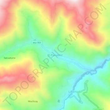
Name: El Porvenir topographic map, elevation, terrain.

Location: El Porvenir, Llata, Huamalíes, Huánuco, Perú (-9.59663 -76.88549 -9.55663 -76.84549)

Average elevation: 3,691 m

Minimum elevation: 3,407 m

Maximum elevation: 4,050 m

Gear up for your next adventure:

🧥Softshell Jacket - Windproof and breathable jacket for hiking
🚲Handlebar Phone Mount - View topographic-map.com live while cycling
🧴Waterproofing Spray - Restore the DWR coating on jackets and tents
🧢Outdoor Visor - Breathable visor for sunny hikes
💧Collapsible Water Bottle - Space-saving water bottle for outdoor activities

As an Amazon Associate, this site earns from qualifying purchases at no extra cost to you.