
Thank you for supporting this site ❤️
Make a donation
Make a donation
Gear up for your next adventure:
As an Amazon Associate, this site earns from qualifying purchases at no extra cost to you.
Kaharoa topographic map
Click on the map to display elevation.
Thank you for supporting this site ❤️
Make a donation
Make a donation
Gear up for your next adventure:
As an Amazon Associate, this site earns from qualifying purchases at no extra cost to you.
About this map
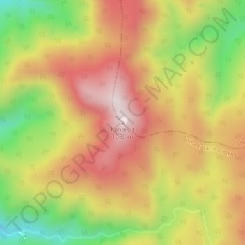
Name: Kaharoa topographic map, elevation, terrain.
Location: Kaharoa, Ōpōtiki District, Bay of Plenty, New Zealand (-38.34393 177.21633 -38.34383 177.21643)
Average elevation: 721 m
Minimum elevation: 381 m
Maximum elevation: 998 m
Thank you for supporting this site ❤️
Make a donation
Make a donation
Gear up for your next adventure:
As an Amazon Associate, this site earns from qualifying purchases at no extra cost to you.