
Mount Coolum topographic map
Interactive map
Click on the map to display elevation.
About this map
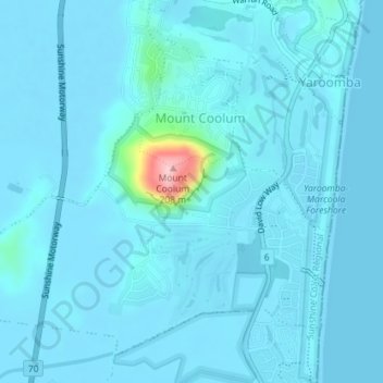
Name: Mount Coolum topographic map, elevation, terrain.
Location: Mount Coolum, Sunshine Coast, Queensland, Australia (-26.57716 153.06343 -26.54986 153.09909)
Average elevation: 12 m
Minimum elevation: 0 m
Maximum elevation: 191 m
Other topographic maps
Click on a map to view its topography, its elevation and its terrain.
Buderim
Australia > Queensland > Sunshine Coast
Buderim, Sunshine Coast, Queensland, 4556, Australia
Average elevation: 39 m