Geolocate

Urbanna topographic map

Click on the map to display elevation.

About this map

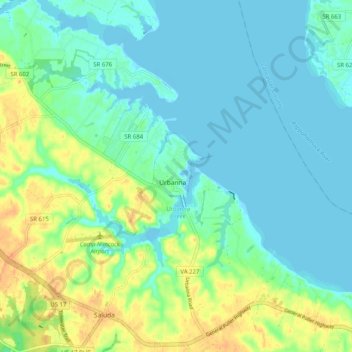
Name: Urbanna topographic map, elevation, terrain.

Location: Urbanna, Middlesex County, Virginia, 23175, United States (37.59764 -76.61440 37.67764 -76.53440)

Average elevation: 11 m

Minimum elevation: -2 m

Maximum elevation: 35 m

Gear up for your next adventure:

📷Outdoor Action Camera - Capture high-elevation views and rugged adventures
🥾Hiking Gaiters - Protect legs and shoes from mud, snow, and debris
🔦UV Flashlight - Detect minerals or specific insects in the dark
🥾Light Trekking Boots - Supportive boots for multi-day treks
Camping Groundsheet - Protect your tent from moisture and dirt

As an Amazon Associate, this site earns from qualifying purchases at no extra cost to you.