Geolocate

Chehalis topographic map

Click on the map to display elevation.

About this map

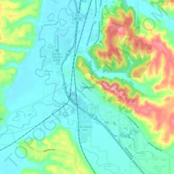
Name: Chehalis topographic map, elevation, terrain.

Location: Chehalis, Lewis County, Washington, United States (46.61997 -123.00343 46.69997 -122.92343)

Average elevation: 85 m

Minimum elevation: 45 m

Maximum elevation: 198 m

Gear up for your next adventure:

🛶Waterproof Dry Bags - Keep electronics and clothes dry during river crossings
🧶550 Survival Paracord - Versatile utility cord for emergency repairs and rigging
🧥Packable Rain Jacket - Breathable waterproof layer for unpredictable weather
🥾Lightweight Hiking Boots - Boots for comfort and mobility on long hikes
💡Compact LED Flashlight - Powerful and portable flashlight for outdoor use

As an Amazon Associate, this site earns from qualifying purchases at no extra cost to you.