
Thank you for supporting this site ❤️
Make a donation
Make a donation
Gear up for your next adventure:
As an Amazon Associate, this site earns from qualifying purchases at no extra cost to you.
Ichocan topographic map
Click on the map to display elevation.
Thank you for supporting this site ❤️
Make a donation
Make a donation
Gear up for your next adventure:
As an Amazon Associate, this site earns from qualifying purchases at no extra cost to you.
About this map
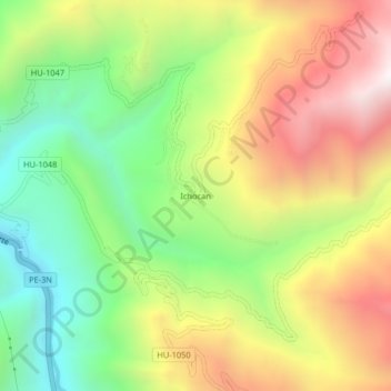
Name: Ichocan topographic map, elevation, terrain.
Location: Ichocan, Ambo, Provincia de Ambo, Huánuco, Perú (-10.19840 -76.16994 -10.15840 -76.12994)
Average elevation: 2,850 m
Minimum elevation: 2,260 m
Maximum elevation: 3,559 m
Thank you for supporting this site ❤️
Make a donation
Make a donation
Gear up for your next adventure:
As an Amazon Associate, this site earns from qualifying purchases at no extra cost to you.