Geolocate

Mayabay topographic map

Click on the map to display elevation.

About this map

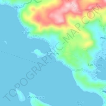
Name: Mayabay topographic map, elevation, terrain.

Location: Mayabay, Daram, Samar, Eastern Visayas, 6722, Philippines (11.60384 124.75054 11.64384 124.79054)

Average elevation: 52 m

Minimum elevation: -1 m

Maximum elevation: 264 m

Other topographic maps

Click on a map to view its topography, its elevation and its terrain.

Badian Island

Philippines > Samar > Daram > Mandoyucan

Average elevation: 13 m

Gear up for your next adventure:

🥤Collapsible Travel Cup - Saves space and weight in your mess kit
🥾Mountain Hiking Boots - High-traction boots for rocky terrain
🧥Softshell Jacket - Windproof and breathable jacket for hiking
🎒Hiking Backpack - Lightweight and ergonomic backpacks for day hikes or multi-day treks
🗺️Topographic Maps - Detailed maps to explore trails, mountains, and wilderness areas

As an Amazon Associate, this site earns from qualifying purchases at no extra cost to you.