Geolocate

Lodève topographic map

Click on the map to display elevation.

About this map
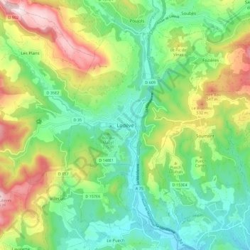
Name: Lodève topographic map, elevation, terrain.

Location: Lodève, Hérault, Occitanie, France métropolitaine, 34700, France (43.69106 3.27892 43.77106 3.35892)

Average elevation: 318 m

Minimum elevation: 116 m

Maximum elevation: 696 m

Gear up for your next adventure:

🧥Softshell Jacket - Windproof and breathable jacket for hiking
🔦UV Flashlight - Detect minerals or specific insects in the dark
🧰Multitool Knife - Compact and versatile tool for outdoor use
💡LED Headlamp - Hands-free illumination for night hiking and camping
🧴Outdoor Sunscreen - High SPF protection for high-altitude UV exposure

As an Amazon Associate, this site earns from qualifying purchases at no extra cost to you.