Geolocate

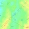
Foul Bay topographic map

Click on the map to display elevation.

About this map

Name: Foul Bay topographic map, elevation, terrain.

Location: Foul Bay, Yorke Peninsula Council, South Australia, 5577, Australia (-35.23824 137.10705 -35.06997 137.36197)

Average elevation: 35 m

Minimum elevation: -1 m

Maximum elevation: 96 m

Other topographic maps

Click on a map to view its topography, its elevation and its terrain.
Gear up for your next adventure:

⛺Camping Tent - Weather-resistant tents suitable for 2 to 6 people
🧦Hiking Socks - Moisture-wicking and comfortable socks for long hikes
🧥Softshell Hiking Jacket - The perfect balance of wind protection and breathability
🪑Ultralight Camping Stool - Compact seating for rest stops during long hikes
🏕️Camping Hammock - Integrated protection for sleeping between trees

As an Amazon Associate, this site earns from qualifying purchases at no extra cost to you.