Geolocate

Casacancha topographic map

Click on the map to display elevation.

About this map

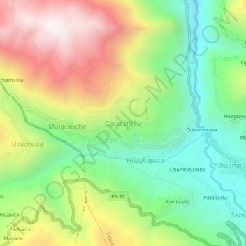
Name: Casacancha topographic map, elevation, terrain.

Location: Casacancha, Talavera, Andahuaylas, Apurímac, Perú (-13.65692 -73.48640 -13.61692 -73.44640)

Average elevation: 3,179 m

Minimum elevation: 2,672 m

Maximum elevation: 3,886 m

Gear up for your next adventure:

🔦UV Flashlight - Detect minerals or specific insects in the dark
🧦Hiking Socks - Moisture-wicking and comfortable socks for long hikes
🥾Waterproof Trail Shoes - Shoes designed to handle wet terrain
🥾Trail Hiking Shoes - Durable shoes designed for rugged trails
🧰Emergency Multi-Tool - Compact multi-tool for outdoor survival

As an Amazon Associate, this site earns from qualifying purchases at no extra cost to you.