Geolocate

Helgerud topographic map

Click on the map to display elevation.

About this map

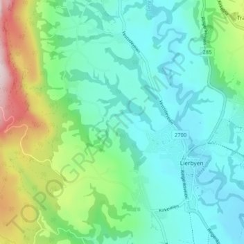
Name: Helgerud topographic map, elevation, terrain.

Location: Helgerud, Lierbyen, Lier, Buskerud, 3404, Norway (59.77328 10.20050 59.81328 10.24050)

Average elevation: 109 m

Minimum elevation: 6 m

Maximum elevation: 423 m

Gear up for your next adventure:

🏕️Camping Hammock - Integrated protection for sleeping between trees
🧦Hiking Liner Socks - Thin base layer to prevent friction and blisters
Lightweight Camping Tent - Portable shelter optimized for Canadian backcountry camping
🛶Waterproof Dry Bags - Keep electronics and clothes dry during river crossings
🥾Approach Shoes - Shoes designed for climbing approaches and rugged trails

As an Amazon Associate, this site earns from qualifying purchases at no extra cost to you.