
Thank you for supporting this site ❤️
Make a donation
Make a donation
Gear up for your next adventure:
As an Amazon Associate, this site earns from qualifying purchases at no extra cost to you.
Jorat-Menthue topographic map
Click on the map to display elevation.
Thank you for supporting this site ❤️
Make a donation
Make a donation
Gear up for your next adventure:
As an Amazon Associate, this site earns from qualifying purchases at no extra cost to you.
About this map
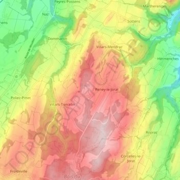
Name: Jorat-Menthue topographic map, elevation, terrain.
Location: Jorat-Menthue, District du Gros-de-Vaud, Vaud, Switzerland (46.59796 6.69842 46.66299 6.76196)
Average elevation: 773 m
Minimum elevation: 599 m
Maximum elevation: 924 m
Thank you for supporting this site ❤️
Make a donation
Make a donation
Gear up for your next adventure:
As an Amazon Associate, this site earns from qualifying purchases at no extra cost to you.