
Falkland topographic map
Click on the map to display elevation.
About this map
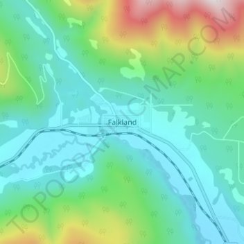
Name: Falkland topographic map, elevation, terrain.
Average elevation: 786 m
Minimum elevation: 564 m
Maximum elevation: 1,501 m
Columbia-Shuswap Regional District trails, hiking, mountain biking, running and outdoor activities
Other topographic maps
Click on a map to view its topography, its elevation and its terrain.
Joyce Lake
Canada > British Columbia > Columbia-Shuswap Regional District > Area D (Falkland/Silver Creek)
Average elevation: 954 m