Geolocate

Manmad topographic map

Click on the map to display elevation.

About this map

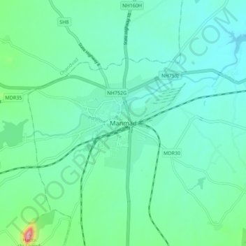
Name: Manmad topographic map, elevation, terrain.

Location: Manmad, Nandgaon, Nashik, Maharashtra, 423104, India (20.21198 74.39923 20.29198 74.47923)

Average elevation: 589 m

Minimum elevation: 539 m

Maximum elevation: 812 m

Gear up for your next adventure:

🌡️Emergency Mylar Blankets - Compact thermal protection for unexpected nights outdoors
🥾All-Terrain Hiking Boots - Versatile boots for varied hiking conditions
🧢Outdoor Visor - Breathable visor for sunny hikes
💧Hydration Bladder - Hands-free hydration solution for long treks
🥾Waterproof Hiking Shoes - Durable shoes for wet and rugged trails

As an Amazon Associate, this site earns from qualifying purchases at no extra cost to you.