Geolocate

Rottstock topographic map

Click on the map to display elevation.

About this map

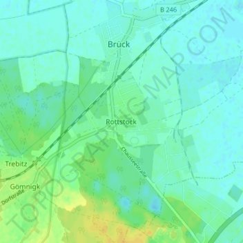
Name: Rottstock topographic map, elevation, terrain.

Location: Rottstock, Brück, Potsdam-Mittelmark, Brandenburg, Deutschland (52.15952 12.73908 52.19952 12.77908)

Average elevation: 49 m

Minimum elevation: 43 m

Maximum elevation: 64 m

Gear up for your next adventure:

🥾Waterproof Trail Shoes - Shoes designed to handle wet terrain
🧣Merino Neck Gaiter - Protects against wind, sun, and cold at high altitudes
🧤Rechargeable Heated Gloves - Extreme warmth for Canadian winter expeditions
🔨Vehicle Emergency Tool - Safety tool for remote road trips to trailheads
🧦Hiking Socks - Moisture-wicking and comfortable socks for long hikes

As an Amazon Associate, this site earns from qualifying purchases at no extra cost to you.