
Creekside topographic map
Click on the map to display elevation.
About this map
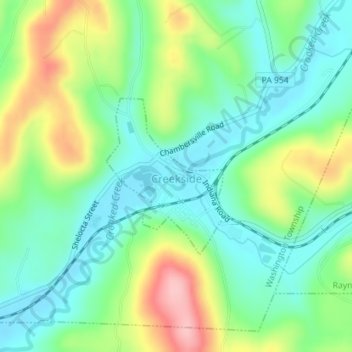
Name: Creekside topographic map, elevation, terrain.
Location: Creekside, Indiana County, Pennsylvania, United States (40.67534 -79.19923 40.68735 -79.18725)
Average elevation: 360 m
Minimum elevation: 309 m
Maximum elevation: 459 m
Other topographic maps
Click on a map to view its topography, its elevation and its terrain.
Dilltown
United States > Pennsylvania > Indiana County > East Wheatfield Township
Average elevation: 474 m
Robinson
United States > Pennsylvania > Indiana County > West Wheatfield Township
Average elevation: 397 m