Geolocate

Saldias topographic map

Click on the map to display elevation.

About this map

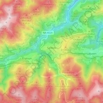
Name: Saldias topographic map, elevation, terrain.

Location: Saldias, Baztan-Bidasoa, Navarre, Spain (43.05985 -1.79483 43.11380 -1.75450)

Average elevation: 650 m

Minimum elevation: 284 m

Maximum elevation: 1,040 m

Gear up for your next adventure:

🛶Kayak Accessories - Essential gear for safe and fun kayaking adventures
👟Sport Hiking Sandals - Breathable footwear for water crossings and camp rest
💡LED Headlamp - Hands-free illumination for night hiking and camping
💧Reusable Water Bottle - Durable water bottles for hydration on trails
🧤Insulated Winter Gloves - Heavy-duty protection for sub-zero Canadian adventures

As an Amazon Associate, this site earns from qualifying purchases at no extra cost to you.