Geolocate

Gangoh topographic map

Click on the map to display elevation.

About this map

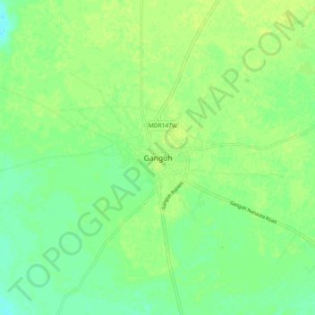
Name: Gangoh topographic map, elevation, terrain.

Location: Gangoh, Nakur, Saharanpur, Uttar Pradesh, 247341, India (29.74063 77.22294 29.82063 77.30294)

Average elevation: 260 m

Minimum elevation: 251 m

Maximum elevation: 265 m

Gear up for your next adventure:

🦟Insect Repellent - Keep mosquitoes and black flies away in wooded areas
💡Solar Camping Lamp - Eco-friendly lighting for campsites
🔋Solar Power Bank - Keep your GPS and devices charged during long outdoor trips
🧦Merino Wool Socks - Moisture-wicking comfort for long-distance hiking
🥾Trail Hiking Boots - Supportive boots for rough trails

As an Amazon Associate, this site earns from qualifying purchases at no extra cost to you.