
Toiras topographic map
Click on the map to display elevation.
About this map
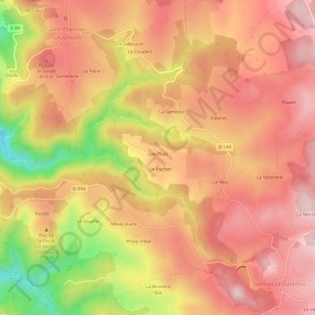
Name: Toiras topographic map, elevation, terrain.
Average elevation: 754 m
Minimum elevation: 560 m
Maximum elevation: 856 m
Other topographic maps
Click on a map to view its topography, its elevation and its terrain.
Chaméane
France > Auvergne-Rhône-Alpes > Puy-de-Dôme > Le Vernet-Chaméane
La topographie du centre du village semble montrer qu’une enceinte enveloppa prieuré, église et dépendances (présence de meurtrières dans la structure de l'église, aujourd’hui non visibles de l'extérieur).
Average elevation: 769 m
Vernet-la-Varenne
France > Auvergne-Rhône-Alpes > Puy-de-Dôme > Le Vernet-Chaméane
Average elevation: 813 m
63580
France > Auvergne-Rhône-Alpes > Puy-de-Dôme > Le Vernet-Chaméane > Le Vernadet
Average elevation: 793 m