Geolocate

Churag topographic map

Click on the map to display elevation.

About this map

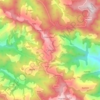
Name: Churag topographic map, elevation, terrain.

Location: Churag, Karsog, Mandi, Himachal Pradesh, 175010, India (31.33200 77.13857 31.37200 77.17857)

Average elevation: 1,760 m

Minimum elevation: 1,419 m

Maximum elevation: 2,016 m

Gear up for your next adventure:

🧴Waterproofing Spray - Restore the DWR coating on jackets and tents
🧥Waterproof Jacket - Lightweight rain jackets for hiking and outdoor activities
🥾Hiking Leggings - Comfortable leggings for outdoor activities
🥘Camping Cookware Set - Compact nesting pots and pans for trail cooking
🥽Outdoor Goggles - Protective eyewear for outdoor activities

As an Amazon Associate, this site earns from qualifying purchases at no extra cost to you.