Geolocate

Viviers topographic map

Click on the map to display elevation.

About this map
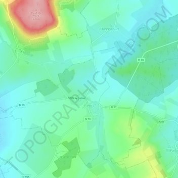
Name: Viviers topographic map, elevation, terrain.

Location: Viviers, Sarrebourg-Château-Salins, Moselle, Grand Est, Metropolitan France, 57590, France (48.87795 6.40770 48.91169 6.46743)

Average elevation: 264 m

Minimum elevation: 227 m

Maximum elevation: 375 m

Other topographic maps

Click on a map to view its topography, its elevation and its terrain.

Entrange Cité

France > Grand Est > Moselle

Average elevation: 237 m

Gear up for your next adventure:

🛏️Sleeping Bag - Warm and compact sleeping bags for outdoor camping
🧢Beanie Hat - Keep your head warm in cold weather
⛺Bushcraft Tarp - Versatile emergency shelter or gear protection
🥾Trail Hiking Shoes - Durable shoes designed for rugged trails
🧥Insulated Jacket - Keep warm in cold outdoor conditions

As an Amazon Associate, this site earns from qualifying purchases at no extra cost to you.