Geolocate

Monte Pora topographic map

Click on the map to display elevation.

About this map
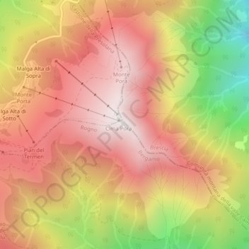
Name: Monte Pora topographic map, elevation, terrain.

Location: Monte Pora, Rogno, Bergamo, Lombardia, 24060, Italia (45.88523 10.10939 45.88533 10.10949)

Average elevation: 1,419 m

Minimum elevation: 716 m

Maximum elevation: 1,869 m

Gear up for your next adventure:

🥾Trail Hiking Boots - Supportive boots for rough trails
🧥Packable Rain Jacket - Breathable waterproof layer for unpredictable weather
🥾Lightweight Hiking Shoes - Comfortable shoes for day hikes
⛺Camping Essentials - All-in-one gear for a comfortable camping trip
🥾Mountain Hiking Shoes - Shoes with superior grip for mountainous terrain

As an Amazon Associate, this site earns from qualifying purchases at no extra cost to you.