Geolocate

Salvia topographic map

Click on the map to display elevation.

About this map

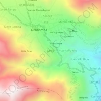
Name: Salvia topographic map, elevation, terrain.

Location: Salvia, Ocobamba, Chincheros, Apurímac, Perú (-13.51080 -73.57573 -13.47080 -73.53573)

Average elevation: 3,159 m

Minimum elevation: 2,549 m

Maximum elevation: 3,911 m

Gear up for your next adventure:

🚲Heavy Duty Bike Lock - Secure your bike at the trailhead or during stops
🥾Mountain Trail Shoes - High-traction shoes for mountain trails
🧭GPS Handheld Device - Reliable GPS navigation for outdoor adventures
🔋Emergency Crank Radio - Weather alerts and power without needing batteries
🔦LED Headlamp - Hands-free lighting for early morning starts or late finishes

As an Amazon Associate, this site earns from qualifying purchases at no extra cost to you.