Geolocate

La Costa topographic map

Click on the map to display elevation.

About this map
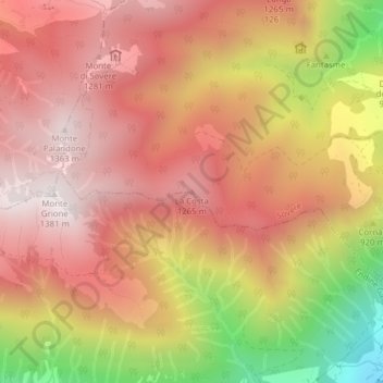
Name: La Costa topographic map, elevation, terrain.

Location: La Costa, Sovere, Bergamo, Lombardia, Italia (45.81137 9.98864 45.81147 9.98874)

Average elevation: 1,000 m

Minimum elevation: 370 m

Maximum elevation: 1,357 m

Gear up for your next adventure:

🥤Collapsible Travel Cup - Saves space and weight in your mess kit
🧤Rechargeable Heated Gloves - Extreme warmth for Canadian winter expeditions
💡Solar Camping Lamp - Eco-friendly lighting for campsites
🧰Multitool Knife - Compact and versatile tool for outdoor use
👟Leg Gaiters - Keep debris, mud, and snow out of your boots

As an Amazon Associate, this site earns from qualifying purchases at no extra cost to you.