Geolocate

Pipers Gap topographic map

Click on the map to display elevation.

About this map

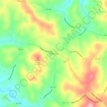
Name: Pipers Gap topographic map, elevation, terrain.

Location: Pipers Gap, Carroll County, Virginia, United States (36.62430 -80.86202 36.66430 -80.82202)

Average elevation: 839 m

Minimum elevation: 755 m

Maximum elevation: 946 m

Other topographic maps

Click on a map to view its topography, its elevation and its terrain.

Laurel Fork

United States > Virginia > Carroll County

Average elevation: 771 m

Chestnut Creek

United States > Virginia > Carroll County > Galax

Average elevation: 757 m

Laurel Fork

United States > Virginia > Carroll County

Average elevation: 785 m

Laurel Fork

United States > Virginia > Carroll County

Average elevation: 804 m

Gear up for your next adventure:

🥾Trekking Poles - Adjustable trekking poles to reduce knee stress and improve stability
🧢Sun Protection Cap - Breathable cap to protect from sun exposure
🧥Waterproof Pants - Keep dry during rainy hiking conditions
🥤Collapsible Travel Cup - Saves space and weight in your mess kit
🧣Merino Neck Gaiter - Protects against wind, sun, and cold at high altitudes

As an Amazon Associate, this site earns from qualifying purchases at no extra cost to you.