
Monte-Carlo topographic map
Interactive map
Click on the map to display elevation.
About this map
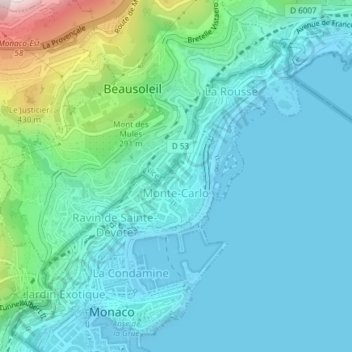
Name: Monte-Carlo topographic map, elevation, terrain.
Location: Monte-Carlo, Monaco (43.73707 7.41915 43.74609 7.43378)
Average elevation: 119 m
Minimum elevation: -1 m
Maximum elevation: 661 m
Other topographic maps
Click on a map to view its topography, its elevation and its terrain.