
Thank you for supporting this site ❤️
Make a donation
Make a donation
Gear up for your next adventure:
As an Amazon Associate, this site earns from qualifying purchases at no extra cost to you.
Majkhali topographic map
Click on the map to display elevation.
Thank you for supporting this site ❤️
Make a donation
Make a donation
Gear up for your next adventure:
As an Amazon Associate, this site earns from qualifying purchases at no extra cost to you.
About this map
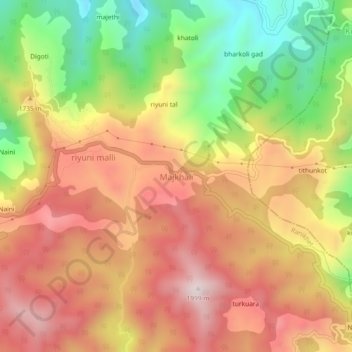
Name: Majkhali topographic map, elevation, terrain.
Location: Majkhali, Ranikhet, Almora, Uttarakhand, 263652, India (29.65819 79.49630 29.69819 79.53630)
Average elevation: 1,662 m
Minimum elevation: 1,293 m
Maximum elevation: 1,962 m
Thank you for supporting this site ❤️
Make a donation
Make a donation
Gear up for your next adventure:
As an Amazon Associate, this site earns from qualifying purchases at no extra cost to you.