Geolocate

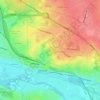
Blet topographic map

Click on the map to display elevation.

About this map

Name: Blet topographic map, elevation, terrain.

Location: Blet, Saint-Amand-Montrond, Cher, Centre-Val de Loire, Metropolitan France, 18350, France (46.84724 2.67085 46.92079 2.78785)

Average elevation: 204 m

Minimum elevation: 168 m

Maximum elevation: 263 m

Other topographic maps

Click on a map to view its topography, its elevation and its terrain.
Diane, 18370

France > Centre-Val de Loire > Cher > Préveranges

Average elevation: 367 m

Le Goyer

France > Centre-Val de Loire > Cher > Vierzon

Average elevation: 135 m

Gear up for your next adventure:

🧥Waterproof Pants - Keep dry during rainy hiking conditions
💡LED Headlamp - Hands-free illumination for night hiking and camping
🧦Merino Wool Socks - Moisture-wicking comfort for long-distance hiking
🥾Lightweight Hiking Boots - Boots for comfort and mobility on long hikes
🥾Waterproof Hiking Boots - Essential footwear for rugged terrain and wet Canadian trails

As an Amazon Associate, this site earns from qualifying purchases at no extra cost to you.