Geolocate

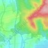
Büdingen topographic map

Click on the map to display elevation.

About this map

Name: Büdingen topographic map, elevation, terrain.

Location: Büdingen, Wetteraukreis, Hesse, 63654, Germany (50.24684 9.07018 50.33637 9.21094)

Average elevation: 217 m

Minimum elevation: 123 m

Maximum elevation: 384 m

Other topographic maps

Click on a map to view its topography, its elevation and its terrain.

Der Haag

Germany > Hesse > Wetteraukreis > Melbach

Average elevation: 155 m

Kreischberg

Germany > Hesse > Wetteraukreis > Büdingen

Average elevation: 213 m

Gear up for your next adventure:

🧊Portable Cooler - Keep food and drinks cold during outdoor adventures
🪑Insulated Seat Pad - Protect your seat from cold rocks and wet logs
🧴Bear Spray Holster - Quick-access carry for essential Canadian wilderness safety
🧥Softshell Jacket - Windproof and breathable jacket for hiking
🥤Collapsible Travel Cup - Saves space and weight in your mess kit

As an Amazon Associate, this site earns from qualifying purchases at no extra cost to you.