Geolocate

Sömmerda topographic map

Click on the map to display elevation.

About this map

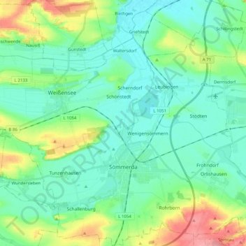
Name: Sömmerda topographic map, elevation, terrain.

Location: Sömmerda, Landkreis Sömmerda, Thuringia, 99610, Germany (51.12171 11.04143 51.24618 11.23796)

Average elevation: 155 m

Minimum elevation: 128 m

Maximum elevation: 237 m

Other topographic maps

Click on a map to view its topography, its elevation and its terrain.

Eßleben

Germany > Thuringia > Landkreis Sömmerda

Average elevation: 230 m

Gear up for your next adventure:

🥾Mountaineering Boots - Supportive boots for climbing and high-altitude hiking
🐕Hiking Dog Pack - Let your canine companion carry their own water and food
Camping Groundsheet - Protect your tent from moisture and dirt
🧼Travel Hand Sanitizer - Keep hands clean when water is scarce
🌬️Windproof Camp Stove - Efficient cooking even on exposed mountain peaks

As an Amazon Associate, this site earns from qualifying purchases at no extra cost to you.