
Thank you for supporting this site ❤️
Make a donation
Make a donation
Gear up for your next adventure:
As an Amazon Associate, this site earns from qualifying purchases at no extra cost to you.
Sobrado topographic map
Click on the map to display elevation.
Thank you for supporting this site ❤️
Make a donation
Make a donation
Gear up for your next adventure:
As an Amazon Associate, this site earns from qualifying purchases at no extra cost to you.
About this map
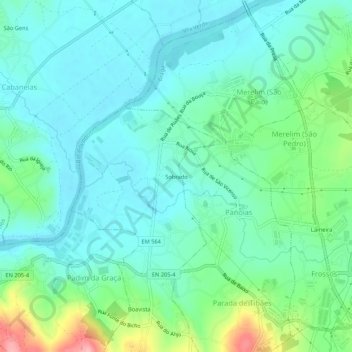
Name: Sobrado topographic map, elevation, terrain.
Location: Sobrado, Mire de Tibães, Braga, 4700-760, Portugal (41.55664 -8.49363 41.59664 -8.45363)
Average elevation: 48 m
Minimum elevation: 16 m
Maximum elevation: 152 m
Thank you for supporting this site ❤️
Make a donation
Make a donation
Gear up for your next adventure:
As an Amazon Associate, this site earns from qualifying purchases at no extra cost to you.