
湖里街道 topographic map
Interactive map
Click on the map to display elevation.
About this map
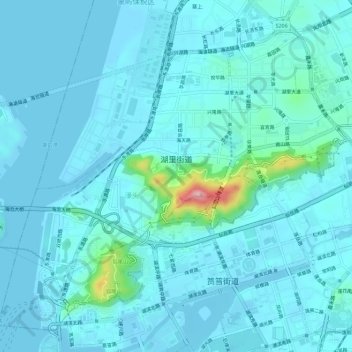
Name: 湖里街道 topographic map, elevation, terrain.
Location: 湖里街道, 湖里区, 厦门市, 福建省, 361006, 中国 (24.47939 118.06337 24.52426 118.11973)
Average elevation: 20 m
Minimum elevation: -2 m
Maximum elevation: 201 m
Other topographic maps
Click on a map to view its topography, its elevation and its terrain.