Geolocate

Cocachimba topographic map

Click on the map to display elevation.

About this map

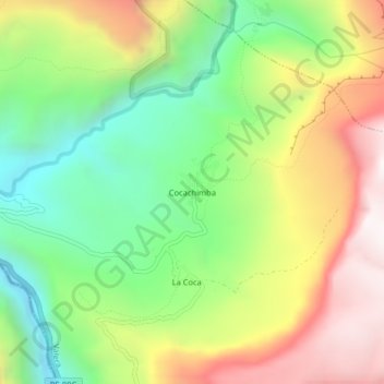
Name: Cocachimba topographic map, elevation, terrain.

Location: Cocachimba, Valera, Bongará, Amazonas, Perú (-6.07811 -77.91497 -6.03811 -77.87497)

Average elevation: 1,970 m

Minimum elevation: 1,425 m

Maximum elevation: 2,671 m

Gear up for your next adventure:

🧢Sun Protection Cap - Breathable cap to protect from sun exposure
💡Compact LED Flashlight - Powerful and portable flashlight for outdoor use
🧭Orienteering Kit - Tools for map reading and navigation in the wild
🥾Trail Running Shoes - Lightweight and durable shoes for trail running
🥾Hiking Boots - Sturdy boots providing ankle support and traction on rugged trails

As an Amazon Associate, this site earns from qualifying purchases at no extra cost to you.