
Thank you for supporting this site ❤️
Make a donation
Make a donation
Gear up for your next adventure:
As an Amazon Associate, this site earns from qualifying purchases at no extra cost to you.
Cotorinho topographic map
Click on the map to display elevation.
Thank you for supporting this site ❤️
Make a donation
Make a donation
Gear up for your next adventure:
As an Amazon Associate, this site earns from qualifying purchases at no extra cost to you.
About this map
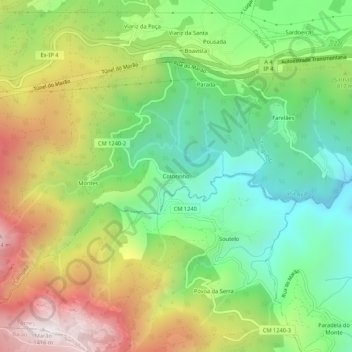
Name: Cotorinho topographic map, elevation, terrain.
Location: Cotorinho, Campeã, Vila Real, 5000-071, Portugal (41.24590 -7.88686 41.28590 -7.84686)
Average elevation: 788 m
Minimum elevation: 364 m
Maximum elevation: 1,404 m
Thank you for supporting this site ❤️
Make a donation
Make a donation
Gear up for your next adventure:
As an Amazon Associate, this site earns from qualifying purchases at no extra cost to you.