
Berthierville topographic map
Interactive map
Click on the map to display elevation.
About this map
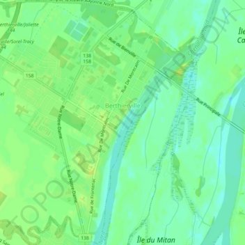
Name: Berthierville topographic map, elevation, terrain.
Location: Berthierville, D'Autray, Lanaudière, Quebec, J0K 1A0, Canada (46.06550 -73.20608 46.09587 -73.16366)
Average elevation: 9 m
Minimum elevation: 0 m
Maximum elevation: 16 m
D'Autray trails, hiking, mountain biking, running and outdoor activities
Other topographic maps
Click on a map to view its topography, its elevation and its terrain.