
Angré topographic map
Interactive map
Click on the map to display elevation.
About this map
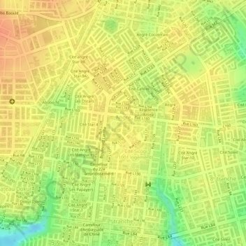
Name: Angré topographic map, elevation, terrain.
Location: Angré, Cocody, Abidjan, 28, Côte d'Ivoire (5.39078 -3.99902 5.41600 -3.97187)
Average elevation: 99 m
Minimum elevation: 67 m
Maximum elevation: 113 m
Other topographic maps
Click on a map to view its topography, its elevation and its terrain.