
Fraser Island topographic map
Interactive map
Click on the map to display elevation.
About this map
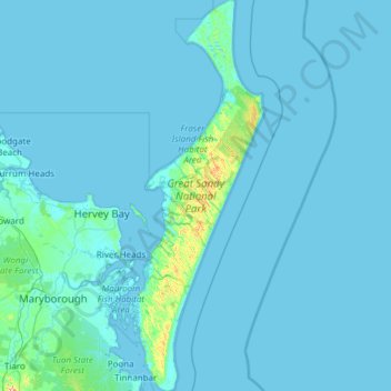
Name: Fraser Island topographic map, elevation, terrain.
Location: Fraser Island, Hervey Bay, Queensland, Australia (-25.79749 152.94269 -24.69714 153.36028)
Average elevation: 11 m
Minimum elevation: -2 m
Maximum elevation: 383 m
Other topographic maps
Click on a map to view its topography, its elevation and its terrain.
Hervey Bay
Australia > Queensland > Hervey Bay
Hervey Bay, Queensland, 4655, Australia
Average elevation: 6 m
Great Sandy National Park
Australia > Queensland > Hervey Bay
Great Sandy National Park, Hervey Bay, Queensland, Australia
Average elevation: 32 m