
Mont Gosford topographic map
Interactive map
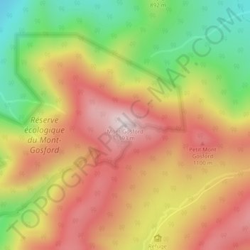
Click on the map to display elevation.
About this map
Name: Mont Gosford topographic map, elevation, terrain.
Average elevation: 933 m
Minimum elevation: 641 m
Maximum elevation: 1,178 m
Since 1978, Mount Gosford is included in "ZEC Louise-Gosford", a controlled harvesting zone open to the public. Recently, the areas at more than 700 metres of altitude were designated Important Bird Areas due to the presence Bicknell's thrushes, an endemic species living in mountain peaks of northeast North America.