
Courrendlin topographic map
Interactive map
Click on the map to display elevation.
About this map
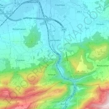
Name: Courrendlin topographic map, elevation, terrain.
Location: Courrendlin, District de Delémont, Jura, 2830, Switzerland (47.30587 7.34836 47.35584 7.44232)
Average elevation: 620 m
Minimum elevation: 412 m
Maximum elevation: 1,276 m