
Les Angles topographic map
Interactive map
Click on the map to display elevation.
About this map
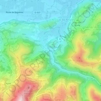
Name: Les Angles topographic map, elevation, terrain.
Average elevation: 529 m
Minimum elevation: 402 m
Maximum elevation: 796 m
Other topographic maps
Click on a map to view its topography, its elevation and its terrain.
Les Angles
France > Occitania > Les Angles
Les Angles, Prades, Pyrénées-Orientales, Occitania, Metropolitan France, 66210, France
Average elevation: 1,819 m