
Redondela topographic map
Interactive map
Click on the map to display elevation.
About this map
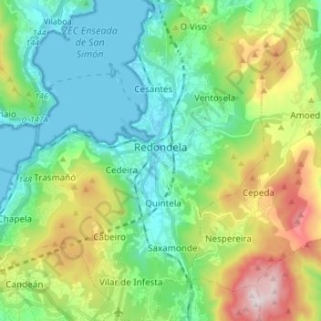
Name: Redondela topographic map, elevation, terrain.
Location: Redondela, Pontevedra, Galicia, España (42.23000 -8.67814 42.32981 -8.56494)
Average elevation: 214 m
Minimum elevation: 0 m
Maximum elevation: 735 m