
O Pui Village topographic map
Interactive map
Click on the map to display elevation.
About this map
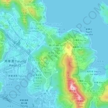
Name: O Pui Village topographic map, elevation, terrain.
Location: O Pui Village, Sai Kung District, Hong Kong, DD243 1557, PRC (22.29200 114.25525 22.33200 114.29525)
Average elevation: 52 m
Minimum elevation: -2 m
Maximum elevation: 310 m