
Handan topographic map
Interactive map
Click on the map to display elevation.
About this map
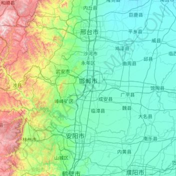
Name: Handan topographic map, elevation, terrain.
Location: Handan, Hebei, 056000, China (36.04840 113.45647 37.02948 115.47722)
Average elevation: 311 m
Minimum elevation: 27 m
Maximum elevation: 2,076 m
Other topographic maps
Click on a map to view its topography, its elevation and its terrain.