
Matsudo topographic map
Interactive map
Click on the map to display elevation.
Matsudo
Matsudo is located in the far northwestern corner of Chiba Prefecture, about 20 to 30 kilometers from the prefectural capital at Chiba and 10 to 20 kilometers from downtown Tokyo. The western border of the city is the Edo River, which flows from north to south, and most of the city is on an alluvial plain with an elevation of only around four meters above sea level, with the eastern end rising to 20 to 30 meters on the Shimōsa Plateau. The city has the approximate dimensions of 11.4 kilometers from east-to-west and 11.6 kilometers from north-to-south.
About this map
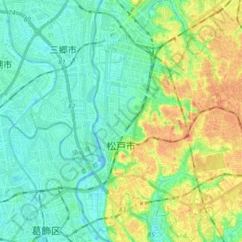
Name: Matsudo topographic map, elevation, terrain.
Location: Matsudo, Chiba Prefecture, Japan (35.74672 139.87939 35.84977 140.00136)
Average elevation: 13 m
Minimum elevation: -7 m
Maximum elevation: 37 m