
Worlcombe Island topographic map
Interactive map
Click on the map to display elevation.
About this map
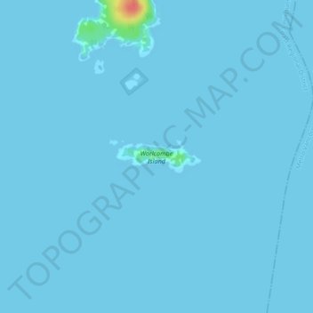
Name: Worlcombe Island topographic map, elevation, terrain.
Average elevation: 1 m
Minimum elevation: -1 m
Maximum elevation: 54 m
Other topographic maps
Click on a map to view its topography, its elevation and its terrain.
Mount Elphinstone
Canada > British Columbia > Area F (West Howe Sound)
Mount Elphinstone, Area F (West Howe Sound), Sunshine Coast Regional District, British Columbia, Canada
Average elevation: 860 m