
Torhout topographic map
Interactive map
Click on the map to display elevation.
About this map
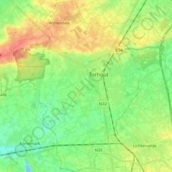
Name: Torhout topographic map, elevation, terrain.
Location: Torhout, Brugge, West Flanders, Belgium (51.01353 3.04354 51.10385 3.15765)
Average elevation: 22 m
Minimum elevation: -13 m
Maximum elevation: 54 m