
Tsuwano topographic map
Interactive map
Click on the map to display elevation.
About this map
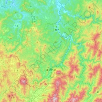
Name: Tsuwano topographic map, elevation, terrain.
Location: Tsuwano, Kanoashi County, Shimane Prefecture, Japan (34.42848 131.66791 34.60159 131.97067)
Average elevation: 330 m
Minimum elevation: 0 m
Maximum elevation: 1,023 m