
Tintigny topographic map
Interactive map
Click on the map to display elevation.
About this map
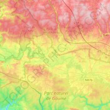
Name: Tintigny topographic map, elevation, terrain.
Location: Tintigny, Virton, Luxembourg, Wallonia, Belgium (49.61936 5.41654 49.78336 5.55666)
Average elevation: 366 m
Minimum elevation: 233 m
Maximum elevation: 479 m