
Ibex Butte topographic map
Interactive map
Click on the map to display elevation.
About this map
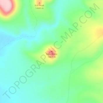
Name: Ibex Butte topographic map, elevation, terrain.
Location: Ibex Butte, Crook County, Oregon, United States (43.81176 -119.97558 43.81186 -119.97548)
Average elevation: 1,360 m
Minimum elevation: 1,299 m
Maximum elevation: 1,503 m