
Emerson topographic map
Interactive map
Click on the map to display elevation.
About this map
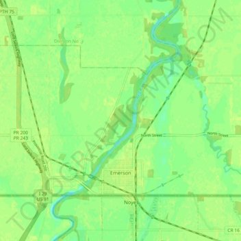
Name: Emerson topographic map, elevation, terrain.
Average elevation: 241 m
Minimum elevation: 232 m
Maximum elevation: 245 m
Other topographic maps
Click on a map to view its topography, its elevation and its terrain.
Arnaud
Canada > Manitoba > Division No. 2 > Municipality of Emerson – Franklin
Arnaud, Municipality of Emerson – Franklin, Division No. 2, Manitoba, Canada
Average elevation: 241 m